![](/images/other/stat-length.png)
![Trail Walking La Couarde-sur-Mer - Loix - Photo](https://media.geolcdn.com/t/1900/400/ext.pjpeg?maxdim=2&url=https%3A%2F%2Fstatic1.geolcdn.com%2Fsiteimages%2Fupload%2Ffiles%2F1553511878bg_sport_marche.png)
Loix
neoroll44
User
![Length](/images/other/stat-length.png)
![Max alt](https://static1.geolcdn.com/siteimages/upload/files/1508320355ic_sort_altitude_max_24dp.png)
![Uphill gradient](https://static1.geolcdn.com/siteimages/upload/files/1508320355ic_sort_den_pos_24dp.png)
![Km-Effort](/images/other/stat-length.png)
![Min alt](https://static1.geolcdn.com/siteimages/upload/files/1508320355ic_sort_altitude_min_24dp.png)
![Downhill gradient](https://static1.geolcdn.com/siteimages/upload/files/1508320355ic_sort_den_neg_24dp.png)
![Boucle](https://static1.geolcdn.com/siteimages/upload/files/16400158638029165_repeat_loop_refresh_sync_direction_icon.png)
![Walking](https://static1.geolcdn.com/sitytour/trail-icons/101.png)
4h20
Difficulty : Medium
![Scan this QR Code to open this trail in the SityTrail application](https://capi.geolives.com/qq0zvz2zws4bq2lad0pu/sitytour/trails/897435/qr.png?size=200)
FREE GPS app for hiking
About
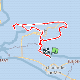
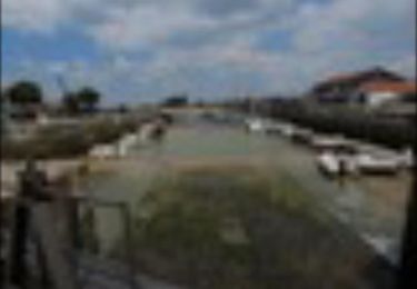
Trail Walking of 18.5 km to be discovered at New Aquitaine, Charente-Maritime, La Couarde-sur-Mer. This trail is proposed by neoroll44.
Description
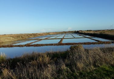
Départ au port de la Couarde-sur-Mer. Partir en direction du Nord-Ouest en suivant le bord des marais salants.
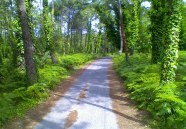
Après 1km de marche, poursuivre, par la droite, sur la piste cyclable qui traverse les marais salants en direction de Loix en Ré.
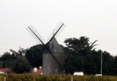
A la sortie du dernier moulin à marée de l'ile, prendre à droite en direction du petit port et traverser ensuite le parking du port pour rejoindre et suivre la piste cyclable. Dépasser la Pointe du Cul d'Ane.
Après environ 600 m, quitter le piste cyclable et emprunter le chemin piéton situé derrière les marais salants pour continuer sur la digue en direction de la pointe du Grouin et son fort.
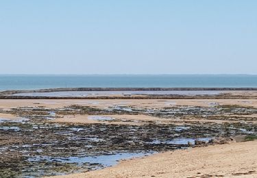
A la cabane des surveillants de baignade, aller sur la plage pour faire le tour de la pointe.
Au Fort du Grouin, continuer sur le chemin du littoral direction plein Ouest. Laisser sur la droite le Pas de la Contre-Ordre, le Pas de la Vette, le Pas des Gaudins, le Pas Malheureux.
Au Pas du Préau continuer sur le digue de terre jusqu'à son extrémité (en face Bois de Trousse-Chemise et Fier d'Ars) et poursuivre.
A la pointe du Croc, faire demi-tour. De retour au parking du Pas du Préau, prendre à droite et longer la digue jusqu'à la fin des marais salants.
A la première intersection, quitter la digue et continuer tout droit jusqu'au centre équestre. Le laisser sur sa droite et poursuivre sur le chemin de terre.
Au lieu-dit L'Oiselière, suivre la rue du même nom qui se poursuit par celle de la Place. Longer ensuite la Place du Marché.
Au centre ville rejoindre le Port de Loix par la Rue Communale puis celle de l'Abbaye.
Traverser le barrage et reprendre le chemin de l'aller jusqu'au retour au point de départ
Positioning
Comments
Trails nearby
![Trail Walking Le Bois-Plage-en-Ré - Promenons-nous dans le bois - Le Bois Plage en Ré - Photo](https://media.geolcdn.com/t/375/260/ext.jpg?maxdim=2&url=https%3A%2F%2Fservices.sitytrail.com%2FGeolivesWS%2FDownloadMedia.ashx%3FTrailID%3D191605%26Media%3D15244_6.jpg)
![Walking Walking](https://static1.geolcdn.com/sitytour/trail-icons/101.png)
Walking
![](/images/other/stat-length.png)
![](https://static1.geolcdn.com/siteimages/upload/files/16400158638029165_repeat_loop_refresh_sync_direction_icon.png)
![Trail Walking Saint-Martin-de-Ré - St Martin-de-Ré à La Flotte - Photo](https://media.geolcdn.com/t/375/260/ext.jpg?maxdim=2&url=https%3A%2F%2Fservices.sitytrail.com%2FGeolivesWS%2FDownloadMedia.ashx%3FTrailID%3D173008%26Media%3D14509_6.jpg)
![Walking Walking](https://static1.geolcdn.com/sitytour/trail-icons/101.png)
Walking
![](/images/other/stat-length.png)
![](https://static1.geolcdn.com/siteimages/upload/files/16400158638029165_repeat_loop_refresh_sync_direction_icon.png)
![Trail Walking La Couarde-sur-Mer - LA COURSE 17 - Photo](https://media.geolcdn.com/t/375/260/ext.jpg?maxdim=2&url=https%3A%2F%2Fservices.sitytrail.com%2FGeolivesWS%2FDownloadMedia.ashx%3FTrailID%3D1079018%26Media%3Dfix__20181130161556.jpg)
![Walking Walking](https://static1.geolcdn.com/sitytour/trail-icons/101.png)
Walking
![](/images/other/stat-length.png)
![](https://static1.geolcdn.com/siteimages/upload/files/16400158638029165_repeat_loop_refresh_sync_direction_icon.png)
![Trail Cycle La Couarde-sur-Mer - Phare des baleines - Photo](https://media.geolcdn.com/t/375/260/ext.jpg?maxdim=2&url=https%3A%2F%2Fservices.sitytrail.com%2FGeolivesWS%2FDownloadMedia.ashx%3FTrailID%3D482505%26Media%3D358ea7a1-e9bd-4bf6-8c26-5d5fb7065c57.jpg)
![Cycle Cycle](https://static1.geolcdn.com/sitytour/trail-icons/200.png)
Cycle
![](/images/other/stat-length.png)
![](https://static1.geolcdn.com/siteimages/upload/files/16400158638029165_repeat_loop_refresh_sync_direction_icon.png)
![Trail Mountain bike La Couarde-sur-Mer - 17-VTT-la-Couarde-Loix-24km - Photo](https://media.geolcdn.com/t/375/260/14f3ef81-b9f6-4f95-94d9-e290600bf134.jpg&format=jpg&maxdim=2)
![Mountain bike Mountain bike](https://static1.geolcdn.com/sitytour/trail-icons/202.png)
Mountain bike
![](/images/other/stat-length.png)
![](https://static1.geolcdn.com/siteimages/upload/files/16400158638029165_repeat_loop_refresh_sync_direction_icon.png)
![Trail Electric bike Saint-Martin-de-Ré - 6 ème jour île de Ré - Photo](https://media.geolcdn.com/t/375/260/c46c4575-ebc7-453b-a233-c053cf269555.jpg&format=jpg&maxdim=2)
![Electric bike Electric bike](https://static1.geolcdn.com/sitytour/trail-icons/205.png)
Electric bike
![](/images/other/stat-length.png)
![](https://static1.geolcdn.com/siteimages/upload/files/16400158638029165_repeat_loop_refresh_sync_direction_icon.png)
![Trail Electric bike Saint-Martin-de-Ré - 5 ème jour île de Ré - Photo](https://media.geolcdn.com/t/375/260/1e0bad21-beec-4153-9ac6-c19b0f39c94d.jpg&format=jpg&maxdim=2)
![Electric bike Electric bike](https://static1.geolcdn.com/sitytour/trail-icons/205.png)
Electric bike
![](/images/other/stat-length.png)
![](https://static1.geolcdn.com/siteimages/upload/files/16400158638029165_repeat_loop_refresh_sync_direction_icon.png)
![Trail Walking Les Portes-en-Ré - rando trousse chemise - Photo](https://media.geolcdn.com/t/375/260/ext.jpg?maxdim=2&url=https%3A%2F%2Fservices.sitytrail.com%2FGeolivesWS%2FDownloadMedia.ashx%3FTrailID%3D939067%26Media%3Dfix__20180406152556.jpg)
![Walking Walking](https://static1.geolcdn.com/sitytour/trail-icons/101.png)
Walking
![](/images/other/stat-length.png)
![](https://static1.geolcdn.com/siteimages/upload/files/16400158638029165_repeat_loop_refresh_sync_direction_icon.png)
![Trail Walking Les Portes-en-Ré - rando trousse chemise - Photo](https://media.geolcdn.com/t/375/260/ext.jpg?maxdim=2&url=https%3A%2F%2Fservices.sitytrail.com%2FGeolivesWS%2FDownloadMedia.ashx%3FTrailID%3D937788%26Media%3Dfix__20180406152556.jpg)
![Walking Walking](https://static1.geolcdn.com/sitytour/trail-icons/101.png)
Walking
![](/images/other/stat-length.png)
![](https://static1.geolcdn.com/siteimages/upload/files/16400158638029165_repeat_loop_refresh_sync_direction_icon.png)